- Itinerary
To witness the highest mountain in the world was until recently a privilege that very few had ...


Goecha La Trek, located in the Sikkim Himalayan Mountains is the best place for trekkers to unlock the Himalayan beauty. This trek is magnificent on the scale of beauty, variety of landscapes and endurance to finish the adventure. You will be the enchanted by the Tshoka Rhododenderon forests, the vast Dzongri and Thansing meadows, the startling blue waters of Samiti lake, the looming presence of Kanchejunga and Pandim, the icy trail to Goecha La leaves you mesmerized. Such is the beauty and charm of the Rhododenderon trees that this trek is famously called Rhododendron trek.
NJP (New Jalpaiguri) is the major railway junction closest to Gangtok. Travelers, who are part of the trek, are picked up from here on a journey to Yuksom that takes 6 hours. Yuksom was once the capital of Sikkim, pleasant and beautiful town rich in culture and heritage. There is a bit of documentation work that needs to be completed to ensure safety through the trek like seeking approval at the police station. Keep a few passport sized photographs handy. For foreign tourists, they need to obtain the trekking permit from Gangtok. Basically, this service will be provided by your respective tourist agencies.
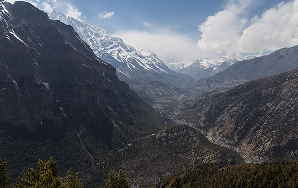
This is when the actual trek begins, you pass through thin forest area and walk over many bridges across rivers which look like a page out of a fairy tale book and this feeling holds good for the rest of the trek. You walk past the check point in Yuksom, few huts until they disappear in the background to reach a V shaped valley of the Rathong river.
You will then walk across the river Pha Khola over a small bridge and pass through the forest area which is so dense that any direct sunray never touches the ground. After 30 minutes, you will come across the Tshushay Khola falls in a series of mini waterfalls joining the Prek River below. Further 50 meters away there is a large iron bridge spans the Tshushay Khola and the trail begins to climb more noticeably. An hour later watch for another small cement bridge over the Mentogang Khola River. Twenty minutes from here we reach the destination of the day – Sachen at 7,150 ft. There is a small clearing, spacious enough to set up a maximum of 10-15 tents and a place to cook. You rest for the night here and can hear the faint noise of the Prek river flowing.
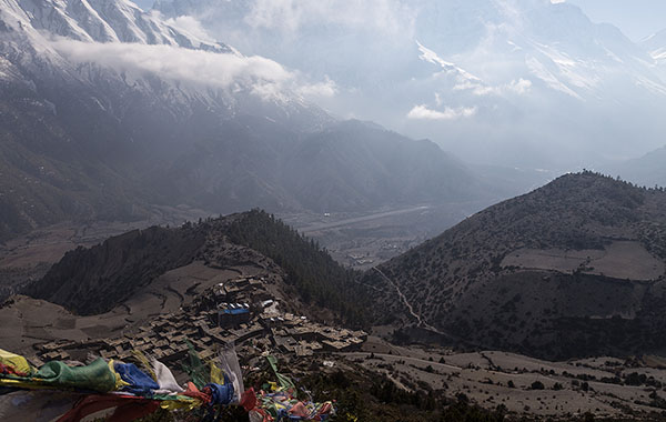
From Sachen, we start walking for 45 minutes until you reach the bridge over River Perk. This is a short trek, but the altitude gain is considerable. The trail climbs sharp through a mixed oak forest and eventually appears the first Rhododendrons. The altitude gain is rapid and the air gets cooler perceptively. With another half hour climb you can reach Bakhim. Bakhim has a Forest Rest House and a lovely tea stall, best place to relax and savor some snacks.
After the short break, start you climb towards Tshoka following the trail just behind the Forest Rest House. Out of the blue, you are in sight of the trekkers hut of Tshoka which also has a flat camping area to the left of the trekkers hut. Alternatively, trekkers can stay at the Forest Rest House slightly uphill. Explore Tshoka, there are cafes where you can try some local beer called Tumba and yak cheese. Make sure you visit the monastery too ! In all this beauty, you can see in the horizon the majestic snow clad peaks of the Kanchenjunga range with Mt Pandim.
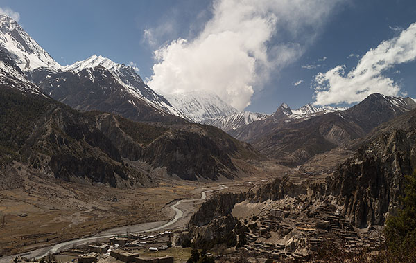
Start from Tshoka, behind the monastery and walk towards the right. This segment of the trek can be considered the most beautiful as we pass along thick red Rhododendron trees. The trail climbs under a canopy of red rhododendrons in full bloom. This a moment to capture as we rarely see a flood of red flowers. You keeping following the trail for 30 minutes and the path is paved by wooden logs with Rhododendrons on both the side. The log path gives way to a regular stony trail that climbs quickly to Phedang in 20 minutes.
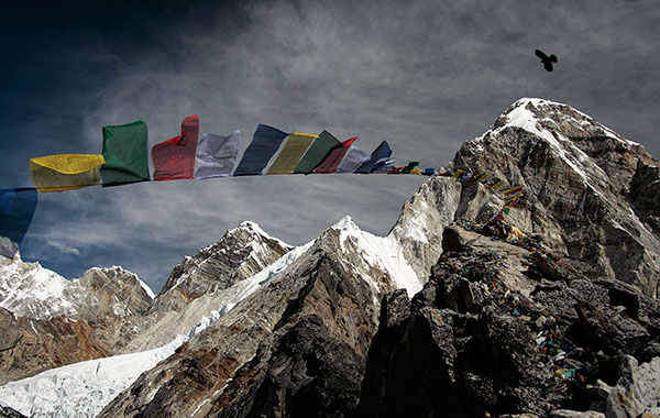
Phedang is a large clearing with amazing views of the snow clad mountains, we stop here for lunch and take some rest. The trail forks at Phedang, take the trail on the left to Dzongri that starts across the clearing which has a steep ascent. The view is great with each step between the Pandim ranges and the Kabru. An hour later the climb tops at a shrine with multitude of prayer flags. This is the highest point of the days trek at 13,080 feet. Take a brief rest at the shrine and follow the trail that gently descends towards Dzongri. There are huts in Dzongri and a gentle clear stream runs by the side of the hut also there are plenty of camping grounds around Dzongri. Dzongri is a large cauldron, mostly meadows, surrounded in all directions by the mighty peaks of the Kanchenjunga range.
Mid way through the trek after gaining an altitude of 12,980ft, your body will be craving for some rest and acclimatization. Enjoy the breath taking beauty, wander around, may be even write a poem or a blog here.
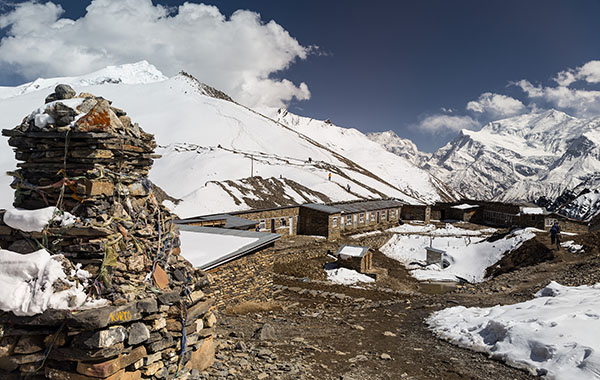
It is very rare to watch the sun behind a snow capped mountain, we trek from our camp site at Dzongri to Dzongri top for 45 minutes is the highest point from where you get the 180 degree panoramic view of the mighty peaks of the Singalila and Kanchenjunga ranges. The sun rises at 5 a.m and you don’t want to miss seeing the first rays of sun hitting Kanchenjunga.
You trace your way back and move towards the next destination i.e., Thansing which is a meadow at the same altitude as Dzongri. The trail from Dzongri to Thansing descends a 1000ft to Kockchurang and then climbs a 1000ft to Thansing. Take the trail heading right from the Dzongri trekkers hut and go to the top of the ridge one kilometer away. From the ridge top you get to see Kanchenjunga, Pandim and the other peaks to the right towering over the meadows. The meadow gently slopes down. The gentle to medium descent continues over 2 hours. The descent becomes steep and you lose more than 500ft. The forest is a good place for some bird watching, you can find them camouflaged.
At the end of the descent is the Kockchurang and the Prekchu river flows close to it. From Kokchurang, walk down to the bridge across Prekchu. The view of the river below and mountains around gives a breathtaking view from the bridge. Soak up the experiences as the water looks icy blue. After this, there is a trekking trail but no lined path. The gradient increases and it’s an ascent throughout and trek for another 2kms to reach Thansing. At the end of the climb is Thansing a big meadow. There is an old abandoned hut which can be used as shelter to cook our dinner, the meadow is flat and vast, innumerable tents can be put up. The open meadow can host any number of tents. You are right in front of Pandim and the left wall of Kanchenjunga here.
The trek from Thansing to Lamuney is easy, pleasant and and as you walk through the meadows, the mountains come closer and closer. The meadows tend to get rockier as you move ahead. The trek is 4.2 kms for over 2 hours. We reach Lamuney which is a flat land where we shall camp for the night. There is the beautiful Samiti lake at 14,100ft takes 45 minutes to reach from Lamuney, it is a steep climb , with a rocky terrain and the once you reach the top, you are invited by the bright blue color of the lake. You can spend some time here, click pictures, enjoy the serene beauty and head back to Lamuney for camping for the night.
Of all the days, today is going to be the longest and demanding one, we start our day at 3 a.m to catch a glimpse of the early morning sunrise, the first sun rays hitting Kanchenjunga. Easier to make it to the sunrise point as the snow is still hard from the previous night and also we have the advantage of reaching Goecha La and return to Kockchurang well in time.
Behind Samiti lake there is a trail that leads to Goecha La, if you notice, that tall peak on your right is Mt. Pandim so the mountain becomes more of a reference point to you. Climb to the ridge on top of Samiti lake and then traverse right on the narrow trail on the flank of the mountain. A bit more of a climb and you reach the sunrise or the first view point of Goecha La. The southeast face of Mt. Kanchenjunga is viewable from the pass. All your trekking efforts will be paid off at this moment when you are a mute spectator to all the glory around you, tall majestic snow clad mountains leaves you mesmerized.
Spend a few moments here before starting your descent to Zemathang. Zemathang is a sand bed covered with snow and gravel. From Zemathang Goecha La is a climb of about one and a half hours. Retrace your path to Lamuney, and then head to Thansing.
The days trek can be divided into two phases. The first from Thansing to Phedang – a direct trail by passing through Dzongri and second, the Rhododendron forest trail from Phedang to Tshoka. While trekking from Thansing to Phedang, we move from one mountain to another all the altitude of 12,000ft! Take the diversion to the left inside the forest instead of climbing up to Dzongri. Rhododendron trees line your way all along and the Prekchu flows below. Look left and at a number of places you get lovely views of Mt. Pandim and its neighbours. Phedang is 10 kms away and this is one of the longest trails between two known campsites. It takes about 4 hours to reach Phedang. From Phedang you retrace the descending trail to Tshoka.
The last day of the trek is going to take a while as all the fun and amazing encounters with nature is all about to end. Retrace your way from Tshoka to Yuksom. We will pass through Bhakim and Sachen along the way until we reach the Yuksom neighborhood.
Leave Yuksom early morning and reach NJP by 4.00 – 5.00 pm.
1. Trek fee inclusive of permit fees and camping charges.
2. Accommodation in tent / guest house during trek.
3. Vegetarian meals during the trek
4. First aid Kit.
5. Camping and Kitchen equipments.
6. Porters and Cooks.
7. Services of an Qualified and experienced Trek Leader to guide over the entire tour.
8. Two night stay in tents / guest house in Yuksom.
9. Transportation from NZP to Yuksom
What's Excluded1. Food/Meal in while travelling from NZP to Yuksom and Yuksom to NZP.
2. Personal expenses and tips.
3. Personal winter and trek requirements like Shoes, clothing, jackets, sun glasses, gloves, and trekking poles
4. Anything not specifically mentioned under the included list.
Note:1- Difficulty of Trek = Medium to Hard
2- Temperature can vary between -5 to 15
3- We expect you to carry your own luggage, if you don’t wish to carry your luggage then you can give it to porter. The charges will be Rs 350 per bag (12 Kg)
Trek Fees
Contact Us